Bathymetry Survey-GARMIN
$470.00
Bathymetry survey is a water mapping activity, data collection, water conditions. The data is then processed, evaluated and presented in the form of books, sea charts and other marine information. This product is then used for development purposes and so on. The scope of hydrographic surveys is of course in waters, rivers, reservoirs, beaches, seas, both surface and seabed.
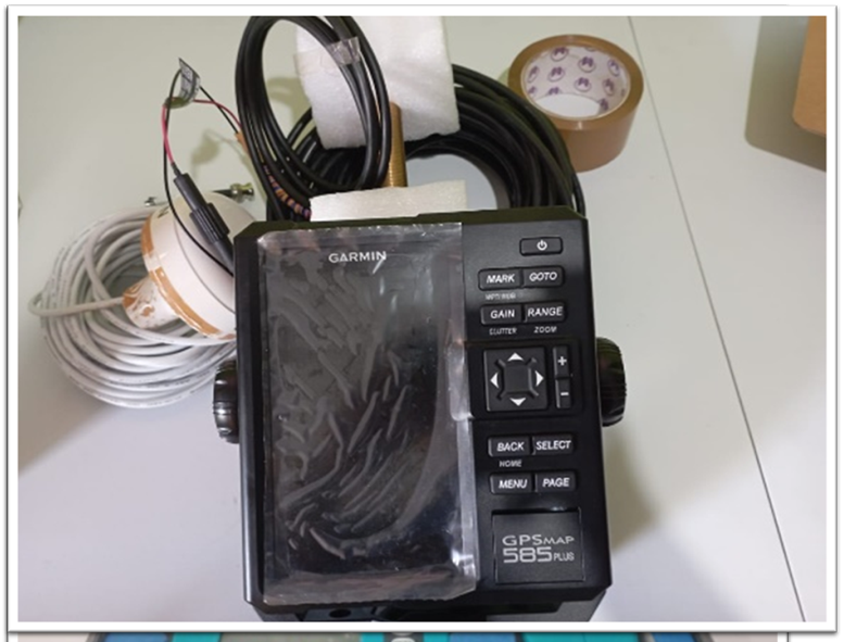
This survey aims to obtain data on the depth or topography of the seabed, including the location and extent of objects in it. Bathymetry surveys using acoustic methods usually use echosounder tools. Data acquisition uses a Garmin 585 Plus GPS equipped with an echosounder sensor. This tool is capable of recording data from a depth of 1m to 500m. recording time can be set according to speed, needs, and conditions in the field.